
Product Details
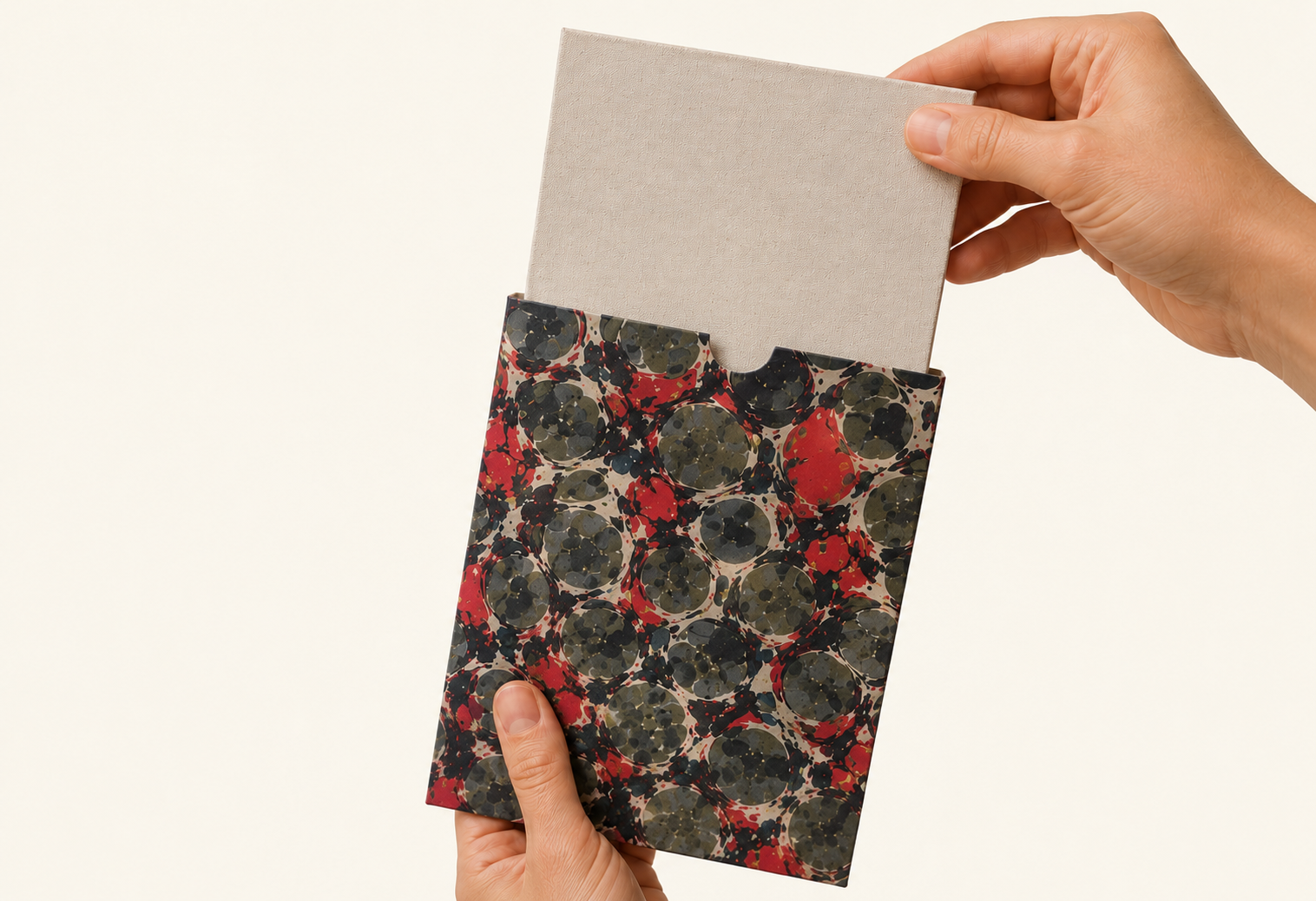
All Maps Come Folded in Their Slip-cases
Making them easy to transport and well-suited for gifting while keeping the maps protected.
Iron-Safe Linen Backing Allows Easy Unfolding and Flattening

The map can be safely ironed at any temperature or setting to help it unfold flat and become frame-ready.
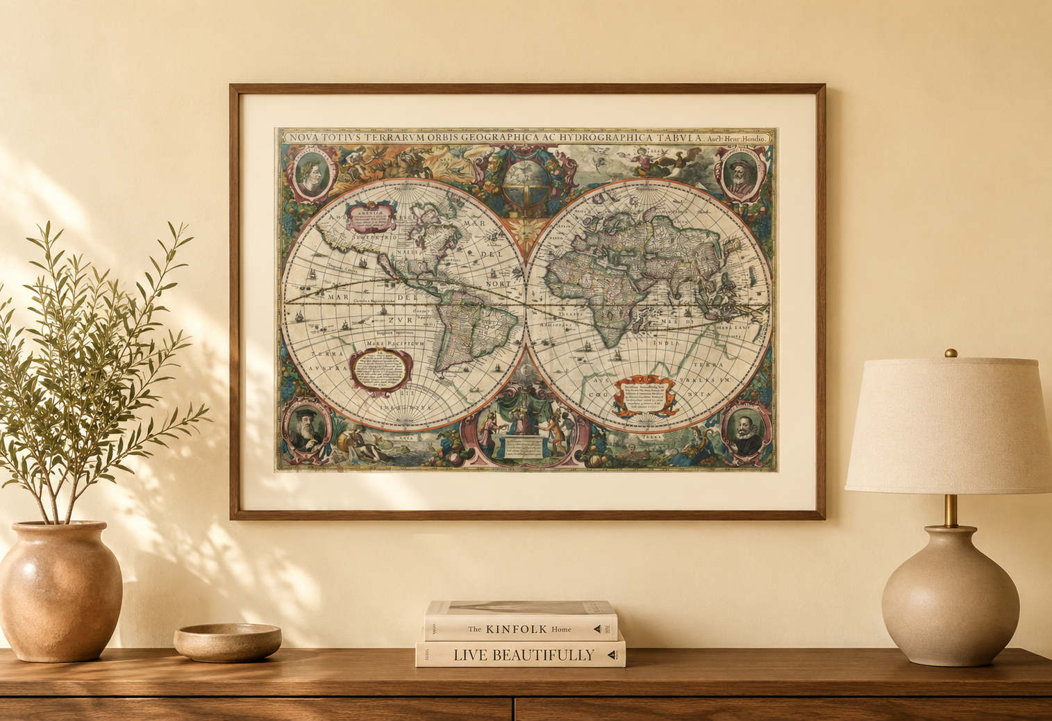
Ready to Frame and Display
Once unfolded and flattened, the map is ready to be framed and displayed as a timeless historical piece.
Start Browsing
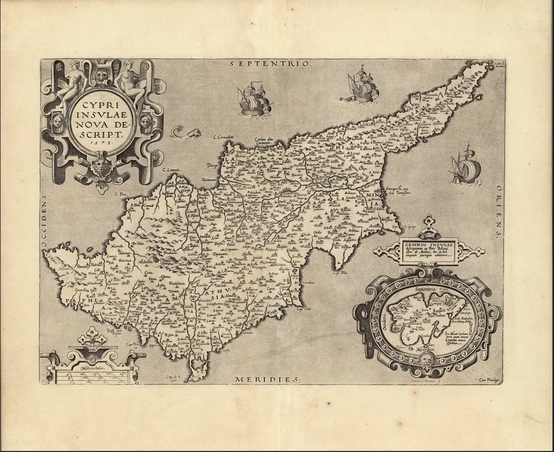
A finely engraved 16th-century map of Cyprus titled “Cypri Insulae Nova Descript.”, showing the island in early Renaissance style with stylised coastlines, mountains, and surrounding Mediterranean waters, typical of decorative atlas maps of the period. This map is associated with Abraham Ortelius (1527–1598) and the Antwerp engraving tradition, published in Theatrum Orbis Terrarum (late 16th century editions).
Each map is hand-laid on linen, enhancing durability and preserving colour over time. The linen backing also allows you to iron the reverse to remove folds and creases.
Supplied folded in a labelled, decorative package as shown in images. (Design of packaging may vary)
Only Available in one size
38 × 48cm
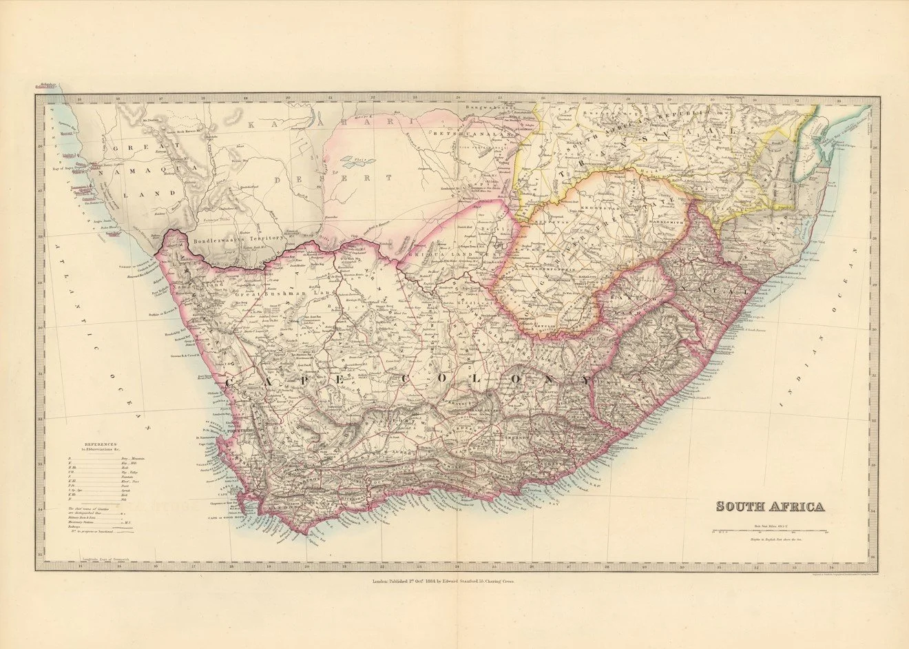
A detailed late 19th century map of South Africa published in 1884 by Edward Stanford of Charing Cross, London, one of the leading Victorian mapmakers.
The map presents the southern African region in clear geographic detail, showing the Cape of Good Hope, Natal and surrounding inland territories with strong emphasis on physical landscape. Mountain ranges, river systems such as the Orange and Limpopo, and major coastal contours are carefully drawn, giving a strong sense of the terrain and scale of the region.
Key towns and developing transport routes are marked throughout, with railways and road lines beginning to connect coastal hubs to inland settlements. The coastline is particularly well defined, highlighting harbours and ports along the southern and eastern seaboard.
Each map is hand-laid on linen, enhancing durability and preserving colour over time. The linen backing also allows you to iron the reverse to remove folds and creases.
Supplied folded in a labelled, decorative package as shown in images. (Design of packaging may vary)
Available in one size
34 × 48cm
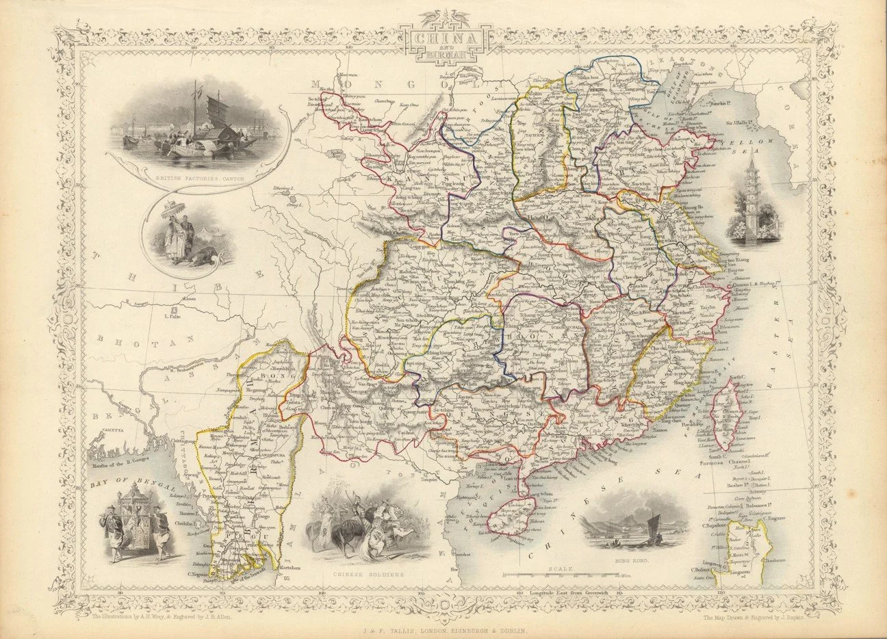
A finely engraved mid-19th century decorative map of China, published circa 1851 as part of John Tallis’s Illustrated Atlas. Drawn and engraved by John Rapkin, it depicts Imperial China along with surrounding regions such as Tibet, Burma, and Formosa (Taiwan), with detailed provincial boundaries, major cities, rivers, and trade routes.
Each map is hand-laid on linen, enhancing durability and preserving colour over time. The linen backing also allows you to iron the reverse to remove folds and creases.
Supplied folded in a labelled, decorative package as shown in images. (Design of packaging may vary)
Only Available in one size
35 × 49cm