
 Image 1 of 4
 Image 2 of 4
 Image 3 of 4
 Image 4 of 4
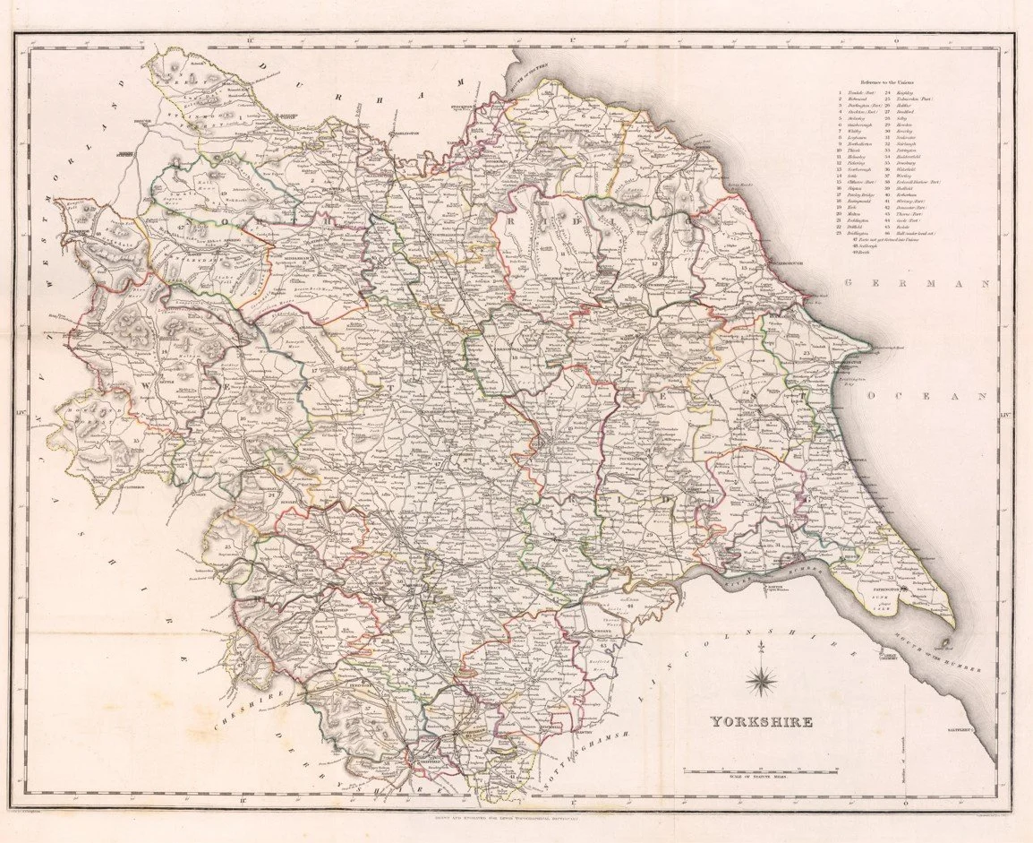
This map of Yorkshire was published in 1844 as part of Samuel Lewis’s Topographical Dictionary of England, engraved by R. Creighton with J & C Walker in London.
It shows Yorkshire divided in full detail, including towns, villages, roads, rivers, rail lines beginning to appear, and parish boundaries, giving a clear picture of the county just before major Victorian industrial expansion reshaped it.
The map is drawn with strong administrative precision, covering the full extent of the historic Ridings and highlighting major centres such as York, Leeds, Sheffield, Hull, and Bradford, making it a practical reference map of mid-19th century England.